
Survey Platting
Ensuring accurate property lines for Utah developers, landowners, and municipalities
Because land surveying establishes boundaries and mapping, it’s an essential part of land development and ownership. The techniques and methods to map and measure land date back to the ancient Egyptians. Over the centuries, the tools and technologies to divide land and obtain measurements have improved to enhance the efficiency and effectiveness of land surveying.
What is a Plat?
A plat is an officially drawn map of a land area that defines property boundaries to scale. Since the plat can’t be created by hand and must be accurate, a plat survey is performed to create this map as accurately as possible. The divided sections of land or boundaries are defined and described in metes and bounds. Metes are distances between two points measured with straight lines while bounds are less specific. Interestingly, this system of describing land has been used for centuries and was applied to the original 13 colonies that became the United States.
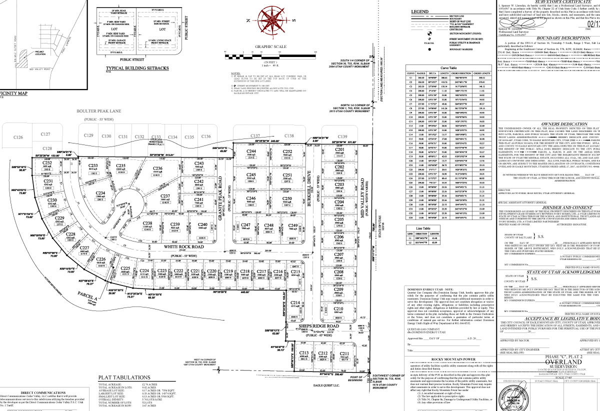
Plats for Land Development
Whether a client plans to divide, add to, or otherwise develop a tract of land, they rely on the FOCUS Survey Department to deliver accurate and timely surveys and then manage the plat review and approval process. FOCUS Survey Department Manager Justin Lundberg and his team work closely with a client to take a large piece of ground and divide it into smaller pieces so the land can be used for commercial and residential projects. They begin by using county data to identify boundaries, topography, utilities, and other improvements and then divide the boundaries based on the findings. By accurately defining property lines, the land can be divided into separate lots to sell or exchange between landowners.
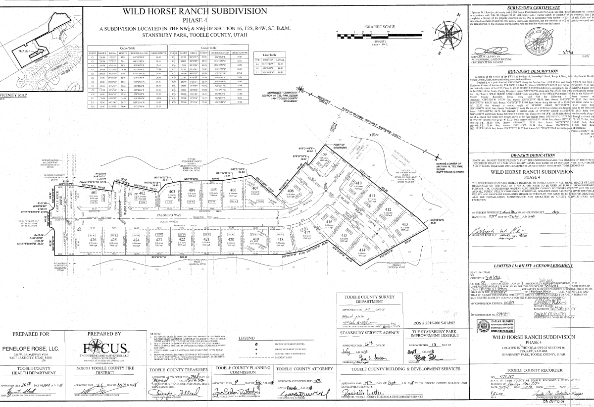
Plat Approval
A final plat is submitted to the applicable governing entity (city and county) for review and once approved FOCUS ensures it is recorded in the office of the county recorder. Navigating this process is made easier by having a clear understanding of codes and requirements as well as good working relationships with municipal government staff. “We work in counties and cities across Utah and have built solid relationships in order to work efficiently with those municipalities,” explains Justin.
With the rapid rate of development in Utah, Justin has seen a shift in requirements and approvals. “Cities and counties have become stricter in their requirements,” he discloses. “They are more careful in looking over the plans and requiring more for accuracy in determining property lines.”
Our team focuses on providing the best customer service possible so we can turn projects around as quickly as possible. We work on this continually – improving customer service to provide the quickest and most accurate plan set.
To learn more about our plat survey services, contact us at 801-352-0072 or info@focusutah.com.
